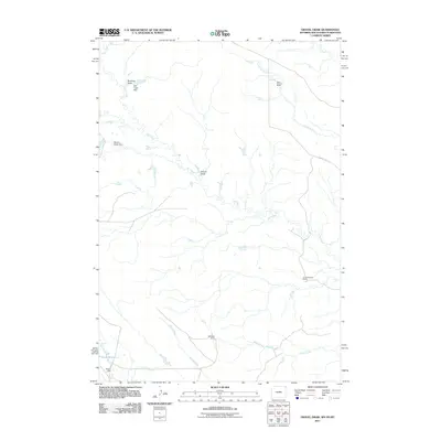
2011 Map of Gravel Draw
USGS Topo · Published 2011About this map
Sloan Brothers Ranch, Courtemanche Ranch, and Geisinger Ranch anchor this landscape where South Dakota, Wyoming, and Montana converge. The terrain is defined by a dendritic network of drainages and seasonal draws, most notably Gravel Draw and the winding course of Owl Creek. Human intervention in this arid environment is evidenced by essential water management infrastructure, including the Moore Dam, which contains the Moore Reservoir in the southwestern corner, alongside the Owl Creek Dam and Mowry Draw Dam. These features illustrate the vital role of water storage in supporting ranching operations throughout Butte County. The presence of Albion Rd provides a primary corridor through the northern sections, while creeks like Lonetree Creek and Ghost Creek further delineate the watershed patterns of this high plains region.
Find a feature on this map
16 named features on this map. Tap any name to fly to it.
Don’t see what you’re looking for? This feature index may not catch every label — zoom into the map to look around manually.
Map Details
Editions of this 2011 Gravel Draw Map
This is the sole edition of this map. No revisions or reprints were ever made.
Other maps of this area

1901 · Aladdin
USGS Topo · 1:125,000

1903 · Aladdin
USGS Topo · 1:125,000

1905 · Indian
USGS Topo · 1:62,500

1907 · Belle Fourche
USGS Topo · 1:125,000

1935 · Harding
USGS Topo · 1:125,000

1953 · Rapid City
USGS Topo · 1:250,000

1954 · Lemmon
USGS Topo · 1:250,000

1954 · Ekalaka
USGS Topo · 1:250,000

1954 · Gillette
USGS Topo · 1:250,000

1955 · Gillette
USGS Topo · 1:250,000