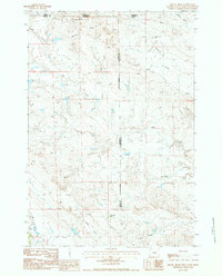
1984 Map of Gravel Draw
USGS Topo · Published 1984About this map
The Black Hills Meridian defines the heart of this high-plains landscape where the borders of Wyoming, Montana, and South Dakota converge. In the early 1980s, this area remained characterized by vast ranching operations and a network of ephemeral waterways. Family-named outposts such as the Geisinger Ranch and Courtemanche Ranch anchor the remote terrain, while the Sloan Brothers Ranch sits near the headwaters of Lonetree Creek.
Find a feature on this map
18 named features on this map. Tap any name to fly to it.
Don’t see what you’re looking for? This feature index may not catch every label — zoom into the map to look around manually.
Map Details
Editions of this 1984 Gravel Draw Map
This is the sole edition of this map. No revisions or reprints were ever made.
Other maps of this area

1901 · Aladdin
USGS Topo · 1:125,000

1903 · Aladdin
USGS Topo · 1:125,000

1905 · Indian
USGS Topo · 1:62,500

1907 · Belle Fourche
USGS Topo · 1:125,000

1935 · Harding
USGS Topo · 1:125,000

1953 · Rapid City
USGS Topo · 1:250,000

1954 · Lemmon
USGS Topo · 1:250,000

1954 · Ekalaka
USGS Topo · 1:250,000

1954 · Gillette
USGS Topo · 1:250,000

1955 · Gillette
USGS Topo · 1:250,000