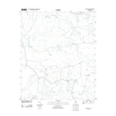
2012 Map of Gravel Hill
USGS Topo · Published 2012About this map
Centerville and Gravel Hill sit within a landscape defined by winding rural routes and numerous family and community burial grounds in this part of Mississippi. The map reveals a high density of small cemeteries, including Centerville Cem, Smiths Chapel Cem, and Shiloh Cem, which point to the long-standing family lineages and local parishes that have shaped these crossroads for generations. In the northwest corner, the Greenwood-Leflore Airport provides a modern contrast to the surrounding creek bottoms and hills. Several significant watercourses, such as Pelucia Cr and Abotcaputa Cr, carve through the terrain, while landmarks like Steen Hill and Millers Hill provide topographical markers for those navigating the network of county roads. The settlement of Shady Grove and scattered sites like the Macrossley Cem illustrate the rural distribution typical of this region during the early 21st century.
Find a feature on this map
63 named features on this map. Tap any name to fly to it.
Don’t see what you’re looking for? This feature index may not catch every label — zoom into the map to look around manually.
Map Details
Editions of this 2012 Gravel Hill Map
This is the sole edition of this map. No revisions or reprints were ever made.
Other maps of this area

1936 · Greenwood
USGS Topo · 1:62,500

1940 · Seven Pines
USGS Topo · 1:62,500

1940 · Greenwood
USGS Topo · 1:62,500

1953 · Greenwood
USGS Topo · 1:250,000

1953 · West Point
USGS Topo · 1:250,000

1954 · McCarley
USGS Topo · 1:62,500

1956 · Greenwood
USGS Topo · 1:250,000

1957 · Greenwood
USGS Topo · 1:62,500

1957 · Seven Pines
USGS Topo · 1:62,500

1958 · West Point
USGS Topo · 1:250,000