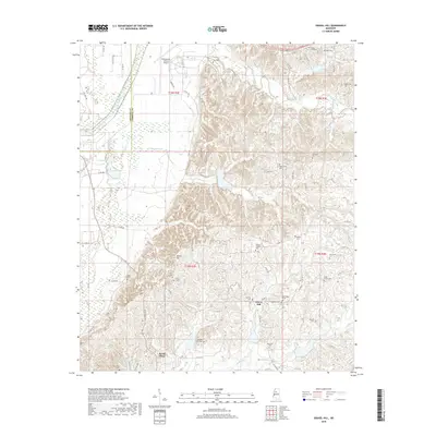
2018 Map of Gravel Hill
USGS Topo · Published 2018About this map
Gravel Hill and the surrounding Carroll County countryside are defined by a complex network of small cemeteries and family burial grounds that reflect the area's deep-rooted settlement history. In this upland landscape east of the Delta, the terrain rises into prominent features like Steen Hill and Millers Hill, while drainage follows winding watercourses such as Abotcaputa Cr and Pelucia Creek. The transition from the flatlands to the east is marked by the Leflore Co Carroll Co boundary line, which cuts through the edge of the Greenwood-Leflore Airport. Genealogists will find a significant concentration of local landmarks, from Shady Grove Cem and Sharkey Pate Cem to the community at Seven Pines. The map details a rural infrastructure of county roads, such as Co RD 180 and Co RD 155, that connect these isolated churches and historic family plots across the rolling terrain.
Find a feature on this map
74 named features on this map. Tap any name to fly to it.
Don’t see what you’re looking for? This feature index may not catch every label — zoom into the map to look around manually.
Map Details
Editions of this 2018 Gravel Hill Map
This is the sole edition of this map. No revisions or reprints were ever made.
Other maps of this area

1936 · Greenwood
USGS Topo · 1:62,500

1940 · Seven Pines
USGS Topo · 1:62,500

1940 · Greenwood
USGS Topo · 1:62,500

1953 · Greenwood
USGS Topo · 1:250,000

1953 · West Point
USGS Topo · 1:250,000

1954 · McCarley
USGS Topo · 1:62,500

1956 · Greenwood
USGS Topo · 1:250,000

1957 · Greenwood
USGS Topo · 1:62,500

1957 · Seven Pines
USGS Topo · 1:62,500

1958 · West Point
USGS Topo · 1:250,000