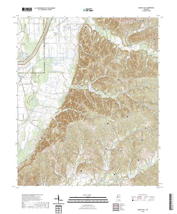
2024 Map of Gravel Hill
USGS Topo · Published 2024About this map
Gravel Hill and the surrounding Carroll County countryside are defined by a network of family cemeteries and rural congregations that trace the genealogy of this Mississippi landscape. The terrain shifts from the flatlands near the Greenwood-Leflore Airport in the west to the more dissected uplands of Steen Hill and Millers Hill in the east. This topographic divide is marked by the winding courses of Pelucia Creek and Abotcaputa Creek, which drain the ridges where numerous historic burial sites are located.
Find a feature on this map
77 named features on this map. Tap any name to fly to it.
Don’t see what you’re looking for? This feature index may not catch every label — zoom into the map to look around manually.
Map Details
Editions of this 2024 Gravel Hill Map
This is the sole edition of this map. No revisions or reprints were ever made.
Other maps of this area

1936 · Greenwood
USGS Topo · 1:62,500

1940 · Seven Pines
USGS Topo · 1:62,500

1940 · Greenwood
USGS Topo · 1:62,500

1953 · Greenwood
USGS Topo · 1:250,000

1953 · West Point
USGS Topo · 1:250,000

1954 · McCarley
USGS Topo · 1:62,500

1956 · Greenwood
USGS Topo · 1:250,000

1957 · Greenwood
USGS Topo · 1:62,500

1957 · Seven Pines
USGS Topo · 1:62,500

1958 · West Point
USGS Topo · 1:250,000