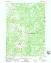
1989 Map of Gravel Peak
USGS Topo · Published 1989About this map
Gravel Peak stands as a prominent high point in this 1980s survey of the high Teton backcountry. The landscape is defined by the protected expanses of the Teton National Forest and the Teton Wilderness, where human impact is largely restricted to remote infrastructure like the Fox Park Patrol Cabin. An intricate network of horse and hiking routes, including the South Boundary Trail (Pack) and the Game Creek Cutoff Trail (Pack), provides the only access through this roadless terrain.
Find a feature on this map
24 named features on this map. Tap any name to fly to it.
Don’t see what you’re looking for? This feature index may not catch every label — zoom into the map to look around manually.
Map Details
Editions of this 1989 Gravel Peak Map
This is the sole edition of this map. No revisions or reprints were ever made.
Other maps of this area

1885 · Lake
USGS Topo · 1:125,000

1895 · Lake
USGS Topo · 1:125,000

1896 · Lake
USGS Topo · 1:125,000

1901 · Lake
USGS Topo · 1:125,000

1902 · Mt Leidy
USGS Topo · 1:125,000

1906 · Lake
USGS Topo · 1:125,000

1911 · Lake
USGS Topo · 1:125,000

1955 · Ashton
USGS Topo · 1:250,000

1955 · Driggs
USGS Topo · 1:250,000

1958 · Driggs
USGS Topo · 1:250,000