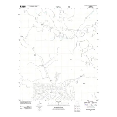
2011 Map of Graveyard Canyon
USGS Topo · Published 2011About this map
Timberon dominates the southern portion of this high-elevation New Mexico survey, showing an intricate residential street network carved into the canyon topography. The community is supported by local infrastructure like the Timberon Airport and Timberon Lodge, while the surrounding land is defined by a series of significant canyons including Graveyard Canyon and Sacramento Canyon. This 2011 record captures the area's transition from a ranching-focused landscape into a more developed mountain retreat.
Find a feature on this map
66 named features on this map. Tap any name to fly to it.
Don’t see what you’re looking for? This feature index may not catch every label — zoom into the map to look around manually.
Map Details
Editions of this 2011 Graveyard Canyon Map
This is the sole edition of this map. No revisions or reprints were ever made.
Other maps of this area

1950 · Escondido Canyon
USGS Topo · 1:62,500

1950 · Alamogordo
USGS Topo · 1:62,500

1952 · Cloudcroft
USGS Topo · 1:62,500

1954 · Carlsbad
USGS Topo · 1:250,000

1958 · Carlsbad
USGS Topo · 1:250,000

1965 · Bear Spring
USGS Topo · 1:24,000

1965 · Surveyors Canyon
USGS Topo · 1:24,000

1965 · Rogers Ruins
USGS Topo · 1:24,000

1965 · El Paso Canyon
USGS Topo · 1:24,000
1974 · Sacramento
USGS Topo · 1:24,000