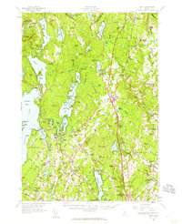
1957 Map of Gray
USGS Topo · Published 1960About this map
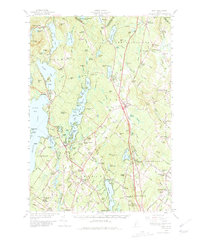
Sebago Lake and the Maine Turnpike anchor this late-1950s landscape, reflecting a region defined by its water bodies and emerging modern infrastructure. The eastern portion of the lake, including Jordan Bay and the Sebago Lake Basin, is dotted with recreational and geographic markers like Raymond Cape and Dollys Island. Inland, the settlement pattern is dense with historic crossroads such as Fosters Corner, Ireland Corner, and Suckerville. The transit network of the era is remarkably visible, showing the shift from rail-based commerce to automotive travel. Major rail lines, including the Grand Trunk and Maine Central, are shown alongside their depots like New Gloucester Sta and Cumberland Center Sta. Local institutions are well-documented, from the Gloucester Hill School to the expansive Pineland Hospital And Training Center. Topographic details reveal the varied terrain of the Cumberland area, including the prominent Rattlesnake Mtn and the distinctively named The Sinkhole.
Find a feature on this map
162 named features on this map. Tap any name to fly to it.
Don’t see what you’re looking for? This feature index may not catch every label — zoom into the map to look around manually.
Map Details
Editions of this 1957 Gray Map
5 editions found
Other maps of this area

1891 · Portland
USGS Topo · 1:62,500

1891 · Buxton
USGS Topo · 1:62,500

1892 · Freeport
USGS Topo · 1:62,500

1892 · Buxton
USGS Topo · 1:62,500

1893 · Portland
USGS Topo · 1:62,500

1893 · Casco Bay
USGS Topo · 1:62,500

1893 · Buxton
USGS Topo · 1:62,500

1894 · Gray
USGS Topo · 1:62,500

1896 · Norway
USGS Topo · 1:62,500

1896 · Sebago
USGS Topo · 1:62,500