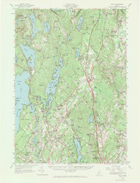
1957 Map of Gray
USGS Topo · Published 1970About this map
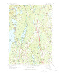
Shaker Village and the expansive Sabbathday Pond anchor the northern landscape of this mid-century survey, illustrating a region defined by its complex hydrology and early industrial transitions. The map detail highlights the development of Gray and North Windham as centers of local commerce, connected by the growing footprint of the Maine Turnpike. Along the eastern edge, the Maine Central railroad corridor remains active, serving stops like New Gloucester Sta and Gray Sta, while the Royal River and Piscataqua River drainage systems influence the placement of numerous small settlements and family farms. Notable institutions such as the Pineland Hospital and Training Center appear alongside local landmarks like the Windham Plains Chapel and the Fish Rearing Sta near Dry Mills. From the shores of Sebago Lake Basin to the heights of Rattlesnake Mtn, the terrain is a mix of agricultural clearings, orchards, and timberland.
Find a feature on this map
94 named features on this map. Tap any name to fly to it.
Don’t see what you’re looking for? This feature index may not catch every label — zoom into the map to look around manually.
Map Details
Editions of this 1957 Gray Map
5 editions found
Other maps of this area

1891 · Portland
USGS Topo · 1:62,500

1891 · Buxton
USGS Topo · 1:62,500

1892 · Freeport
USGS Topo · 1:62,500

1892 · Buxton
USGS Topo · 1:62,500

1893 · Portland
USGS Topo · 1:62,500

1893 · Casco Bay
USGS Topo · 1:62,500

1893 · Buxton
USGS Topo · 1:62,500

1894 · Gray
USGS Topo · 1:62,500

1896 · Norway
USGS Topo · 1:62,500

1896 · Sebago
USGS Topo · 1:62,500