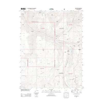
2013 Map of Gray Head
USGS Topo · Published 2013About this map
Uncompahgre National Forest dominates this high-altitude landscape, where the San Miguel River carves through the northern half of the quadrangle. Early 21st-century settlement patterns are visible in the modern development of Mountain Village and the industrial remnants at Vance Junction and Vanadium. The map documents a complex topography defined by Wilson Mesa and Sunshine Mesa, which are accessible via an extensive network of footpaths including the Galloping Goose Trail and Wilson Mesa Trail. A unique juxtaposition of historical mountain travel and modern infrastructure is present, as the Telluride Regional Airport sits atop Deep Creek Mesa, overlooking the old route to Ilium. Significant water features like the South Fork San Miguel River and Cushman Lake highlight the area's drainage systems below peaks such as Gray Head and Last Dollar Mountain.
Find a feature on this map
62 named features on this map. Tap any name to fly to it.
Don’t see what you’re looking for? This feature index may not catch every label — zoom into the map to look around manually.
Map Details
Editions of this 2013 Gray Head Map
This is the sole edition of this map. No revisions or reprints were ever made.
Other maps of this area

1897 · Telluride
USGS Topo · 1:62,500

1904 · Telluride
USGS Topo · 1:62,500

1909 · Montrose
USGS Topo · 1:125,000

1911 · Montrose
USGS Topo · 1:125,000

1945 · Durango
USGS Topo · 1:250,000

1953 · Mount Wilson
USGS Topo · 1:24,000

1953 · Dolores Peak
USGS Topo · 1:24,000

1953 · Placerville
USGS Topo · 1:24,000
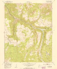
1953 · Gray Head
USGS Topo · 1:24,000

1953 · Little Cone
USGS Topo · 1:24,000