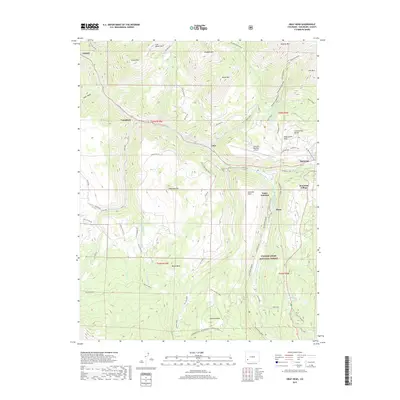
2019 Map of Gray Head
USGS Topo · Published 2019About this map
Uncompahgre National Forest encompasses much of this high-altitude landscape, where the San Miguel River and its South Fork carve deep through the mesas of San Miguel County. The map documents a fascinating spatial history of industry and tourism, from the former settlement at Vanadium and the rail-aligned history of Vance Junction to the modern development of Mountain Village. High-elevation landmarks like Gray Head and Whipple Mtn tower over the Deep Creek Mesa, while the Telluride Regional Airport occupies a prominent plateau above the river valley. Traces of historical movement are visible in the network of routes like the Galloping Goose trail and the Ilium Flume, which follow the rugged contours between Ilium and Sunshine. Notable water features including Cushman Lake and the Alta Lakes are tucked into the southeastern highlands, providing a detailed look at the hydrology of the Continental Divide region.
Find a feature on this map
67 named features on this map. Tap any name to fly to it.
Don’t see what you’re looking for? This feature index may not catch every label — zoom into the map to look around manually.
Map Details
Editions of this 2019 Gray Head Map
This is the sole edition of this map. No revisions or reprints were ever made.
Other maps of this area

1897 · Telluride
USGS Topo · 1:62,500

1904 · Telluride
USGS Topo · 1:62,500

1909 · Montrose
USGS Topo · 1:125,000

1911 · Montrose
USGS Topo · 1:125,000

1945 · Durango
USGS Topo · 1:250,000

1953 · Mount Wilson
USGS Topo · 1:24,000

1953 · Dolores Peak
USGS Topo · 1:24,000

1953 · Placerville
USGS Topo · 1:24,000
1953 · Gray Head
USGS Topo · 1:24,000

1953 · Little Cone
USGS Topo · 1:24,000