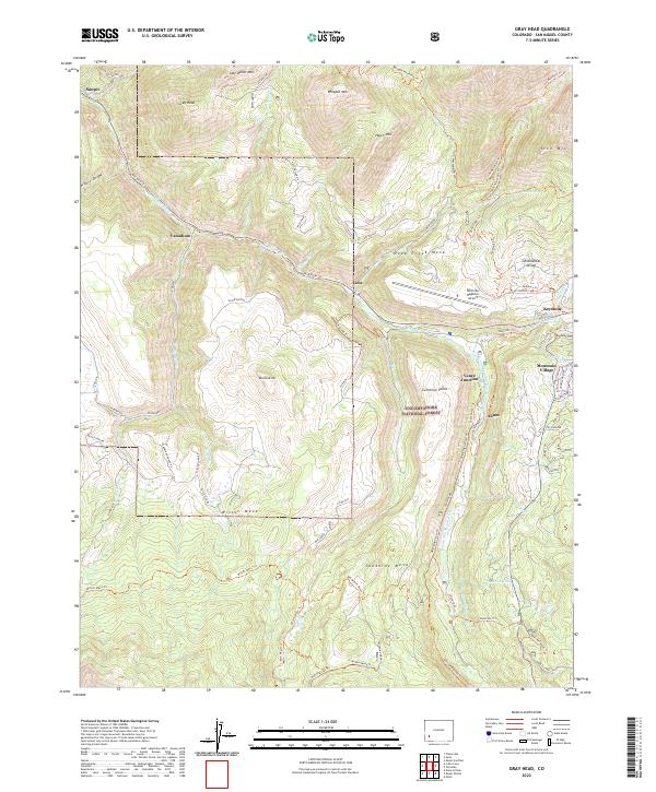
2022 Map of Gray Head
USGS Topo · Published 2022About this map
Uncompahgre National Forest dominates this high-elevation landscape, where the San Miguel River carves through a corridor once vital to the region's mining and industrial history. The map documents a cluster of historical settlements and transit points including Sawpit, Vanadium, and Lime, marking where silver and vanadium ores were once processed or shipped. Modern aviation and recreation infrastructure now overlay these older roots, notably the Telluride Regional Airport perched atop Deep Creek Mesa and the nearby Mountain Village.
Find a feature on this map
77 named features on this map. Tap any name to fly to it.
Don’t see what you’re looking for? This feature index may not catch every label — zoom into the map to look around manually.
Map Details
Editions of this 2022 Gray Head Map
This is the sole edition of this map. No revisions or reprints were ever made.
Other maps of this area

1897 · Telluride
USGS Topo · 1:62,500

1904 · Telluride
USGS Topo · 1:62,500

1909 · Montrose
USGS Topo · 1:125,000

1911 · Montrose
USGS Topo · 1:125,000

1945 · Durango
USGS Topo · 1:250,000

1953 · Mount Wilson
USGS Topo · 1:24,000

1953 · Dolores Peak
USGS Topo · 1:24,000

1953 · Placerville
USGS Topo · 1:24,000
1953 · Gray Head
USGS Topo · 1:24,000

1953 · Little Cone
USGS Topo · 1:24,000