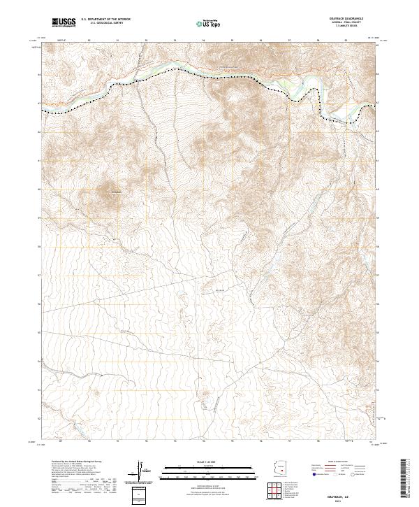
2021 Map of Grayback
USGS Topo · Published 2021About this map
The Gila River cuts a deep path through the northern reach of this Pinal County landscape, flanked by the dramatic topography of The Spine and the winding Walnut Canyon. The terrain is defined by a network of drainage systems, including Zelleweger Wash and Ripsey Wash, which shape the canyons and ridges surrounding the settlement at Grayback.
Find a feature on this map
21 named features on this map. Tap any name to fly to it.
Don’t see what you’re looking for? This feature index may not catch every label — zoom into the map to look around manually.
Map Details
Editions of this 2021 Grayback Map
This is the sole edition of this map. No revisions or reprints were ever made.
Other maps of this area

1900 · Florence
USGS Topo · 1:125,000

1902 · Florence
USGS Topo · 1:125,000

1910 · Ray
USGS Topo · 1:62,500

1911 · Winkelman
USGS Topo · 1:125,000

1913 · Winkelman
USGS Topo · 1:125,000

1934 · Newman Peak
USGS Topo · 1:125,000

1949 · Crozier Peak
USGS Topo · 1:24,000

1949 · Winkelman
USGS Topo · 1:62,500
1950 · Crozier Peak
USGS Topo · 1:24,000
1951 · Winkelman
USGS Topo · 1:62,500