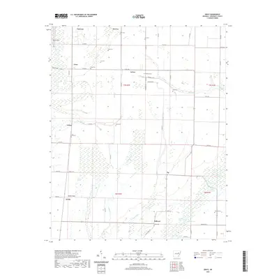
2020 Map of Grays
USGS Topo · Published 2020About this map
The agricultural landscape of Woodruff County dominates this 2020 survey, where the Cache River valley's complex drainage network defines the land. Small communities such as Grays, DeView, and Wiville are scattered among a grid of section lines and country roads. The hydrology is particularly intricate here, with the meandering Bayou De View flowing through the eastern reaches, joined by numerous sloughs and lakes like Broom Lake and Lost Lake. The presence of many family-named cemeteries, including Gray Cem, Easton Cem, and Angus Cem, provides a detailed record of the area's rural heritage. This map illustrates the intersection of modern infrastructure and natural water features, showing how Buffalo Cr and Locust Slough wind through the cultivated fields of the Delta. From the high point of Nubbin Ridge to the lowlands of Hurricane Lake, the map captures the transition between managed farmland and the wetlands characteristic of eastern Arkansas.
Find a feature on this map
73 named features on this map. Tap any name to fly to it.
Don’t see what you’re looking for? This feature index may not catch every label — zoom into the map to look around manually.
Map Details
Editions of this 2020 Grays Map
This is the sole edition of this map. No revisions or reprints were ever made.
Other maps of this area

1935 · Augusta
USGS Topo · 1:62,500

1935 · Gregory
USGS Topo · 1:62,500

1939 · Hunter
USGS Topo · 1:62,500

1940 · Tilton
USGS Topo · 1:62,500

1953 · Memphis
USGS Topo · 1:250,000

1956 · Memphis
USGS Topo · 1:250,000

1956 · Tilton
USGS Topo · 1:62,500

1956 · Hunter
USGS Topo · 1:62,500

1957 · Augusta
USGS Topo · 1:62,500

1957 · Gregory
USGS Topo · 1:62,500