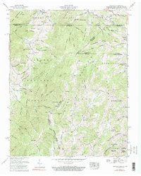
1959 Map of Grayson
USGS Topo · Published 1990About this map
The high mountain borderlands of Virginia, Tennessee, and North Carolina meet on this survey, highlighting the remote topography of the Jefferson National Forest and Cherokee National Forest. Settlement is concentrated along the narrow valleys and gaps, with Taylors Valley and Green Cove serving as primary locales connected by the Norfolk and Western line. This railroad route snakes through the northern territory, skirting the base of Iron Mountain and Snaggy Mountain.
Find a feature on this map
120 named features on this map. Tap any name to fly to it.
Don’t see what you’re looking for? This feature index may not catch every label — zoom into the map to look around manually.
Map Details
Editions of this 1959 Grayson Map
3 editions found

Other maps of this area

1891 · Abingdon
USGS Topo · 1:125,000

1893 · Cranberry
USGS Topo · 1:125,000

1894 · Abingdon
USGS Topo · 1:125,000

1895 · Cranberry
USGS Topo · 1:125,000

1899 · Cranberry
USGS Topo · 1:125,000

1902 · Cranberry
USGS Topo · 1:125,000

1909 · Abingdon
USGS Topo · 1:96,000

1911 · Abingdon
USGS Topo · 1:125,000

1935 · Konnarock
USGS Topo · 1:24,000

1935 · Grayson
USGS Topo · 1:24,000