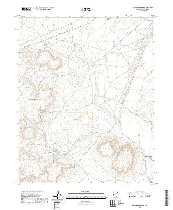
2021 Map of Greasewood Spring
USGS Topo · Published 2021About this map
Greasewood Spring sits at the heart of this high-desert landscape in Navajo County, anchoring a region of mesas and wide valleys. The geography is dominated by the massive Wood Chop Mesa in the west and the distinct geological formations of Twin Buttes to the east and south. This map details an arid environment where water sources like Martinez Spring and the seasonal drainage of Steamboat Wash were critical for sustaining local life and movement. The presence of Pueblo Colorado Valley and the Pueblo Colorado Wash in the southeast suggests a corridor of historical importance, while a grid of routes such as Indian Rte 15 and N 153 reveals the modern infrastructure connecting these ancestral lands. The land is organized by the Public Land Survey System, showing the townships of t24n r22e, t24n r23e, t23n r22e, and t23n r23e.
Find a feature on this map
20 named features on this map. Tap any name to fly to it.
Don’t see what you’re looking for? This feature index may not catch every label — zoom into the map to look around manually.
Map Details
Editions of this 2021 Greasewood Spring Map
This is the sole edition of this map. No revisions or reprints were ever made.
Other maps of this area

1883 · Tusayan
USGS Topo · 1:250,000

1886 · Tusayan
USGS Topo · 1:250,000

1886 · Fort Defiance
USGS Topo · 1:250,000

1892 · Fort Defiance
USGS Topo · 1:250,000

1947 · Flagstaff
USGS Topo · 1:250,000

1954 · Flagstaff
USGS Topo · 1:250,000

1954 · Gallup
USGS Topo · 1:250,000

1958 · Gallup
USGS Topo · 1:250,000

1958 · Flagstaff
USGS Topo · 1:250,000

1959 · Gallup
USGS Topo · 1:250,000