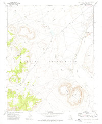
1972 Map of Greasewood Spring
USGS Topo · Published 1977About this map
Navajo Indian Reservation lands in the early 1970s are defined by a complex desert hydrology and prominent landforms. The landscape is marked by the convergence of Steamboat Wash and Pueblo Colorado Wash, ephemeral drainages that shape the arid terrain. Natural water sources like Martinez Spring and the namesake Greasewood Spring provided critical focal points for activity in this high-desert environment.
Find a feature on this map
9 named features on this map. Tap any name to fly to it.
Don’t see what you’re looking for? This feature index may not catch every label — zoom into the map to look around manually.
Map Details
Editions of this 1972 Greasewood Spring Map
This is the sole edition of this map. No revisions or reprints were ever made.
Other maps of this area

1883 · Tusayan
USGS Topo · 1:250,000

1886 · Tusayan
USGS Topo · 1:250,000

1886 · Fort Defiance
USGS Topo · 1:250,000

1892 · Fort Defiance
USGS Topo · 1:250,000

1947 · Flagstaff
USGS Topo · 1:250,000

1954 · Flagstaff
USGS Topo · 1:250,000

1954 · Gallup
USGS Topo · 1:250,000

1958 · Gallup
USGS Topo · 1:250,000

1958 · Flagstaff
USGS Topo · 1:250,000

1959 · Gallup
USGS Topo · 1:250,000