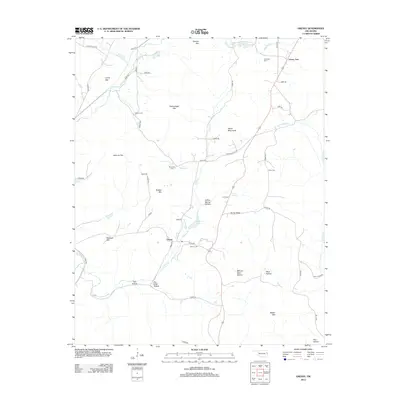
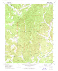
2012 Map of Greasy
USGS Topo · Published 2012About this map
The settlement of Greasy lies at the heart of this Adair County landscape, where the waters of Greasy Cr and Beaver Br converge near the foot of Hudson Mtn. This 2012 survey illustrates a region defined by its prominent ridges and hollows, including the Welch Mountains and the heights of Dahlonegah Mtn. Genealogists will find significant value in the distribution of family and community burial grounds throughout the terrain, such as Chuculate Cem, Beaver Cem, and the remote Killer Cem located south of Cherry Tree. The map documents a rural infrastructure where local routes like Greasy School Rd and Bunch Rd connect isolated homesteads and natural landmarks. From the secluded Yellow Spring Hollow to the eastern drainage of Jenkins Cr, the map preserves the contemporary placement of traditional Ozark foothills landmarks.
Find a feature on this map
59 named features on this map. Tap any name to fly to it.
Don’t see what you’re looking for? This feature index may not catch every label — zoom into the map to look around manually.
Map Details
Editions of this 2012 Greasy Map
This is the sole edition of this map. No revisions or reprints were ever made.
Other maps of this area

1898 · Tahlequah
USGS Topo · 1:125,000

1901 · Tahlequah
USGS Topo · 1:125,000

1905 · Tahlequah
USGS Topo · 1:125,000

1946 · Fort Smith
USGS Topo · 1:250,000

1965 · Fort Smith
USGS Topo · 1:250,000

1967 · Fort Smith
USGS Topo · 1:250,000
1972 · Marble City
USGS Topo · 1:24,000
1972 · Stilwell West
USGS Topo · 1:24,000
1972 · Tailholt
USGS Topo · 1:24,000
1972 · Bunch
USGS Topo · 1:24,000