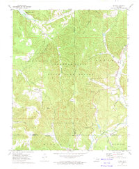
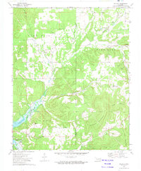
1972 Map of Bunch
USGS Topo · Published 1974About this map
Cookson Hills terrain dominates this 1970s survey, illustrating a landscape defined by deep hollows and high ridges across the borders of Adair, Cherokee, and Sequoyah counties. The Cookson State Game Refuge encompasses a significant portion of the central highlands, with the Game Refuge Headquarters and the Beaver Lookout Tower providing infrastructure for wildlife management. To the northwest, the waters of Tenkiller Ferry Lake reach into the drainage of Dry Creek.
Find a feature on this map
48 named features on this map. Tap any name to fly to it.
Don’t see what you’re looking for? This feature index may not catch every label — zoom into the map to look around manually.
Map Details
Editions of this 1972 Bunch Map
This is the sole edition of this map. No revisions or reprints were ever made.
Other maps of this area

1898 · Tahlequah
USGS Topo · 1:125,000

1901 · Tahlequah
USGS Topo · 1:125,000

1905 · Tahlequah
USGS Topo · 1:125,000

1946 · Fort Smith
USGS Topo · 1:250,000

1965 · Fort Smith
USGS Topo · 1:250,000

1967 · Fort Smith
USGS Topo · 1:250,000
1972 · Blackgum
USGS Topo · 1:24,000
1972 · Marble City
USGS Topo · 1:24,000
1972 · Stilwell West
USGS Topo · 1:24,000
1972 · Tailholt
USGS Topo · 1:24,000