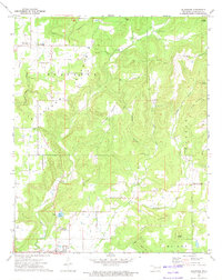
1972 Map of Blackgum
USGS Topo · Published 1974About this map
Vian Creek Ch and the neighboring Barnosky Cem sit among the ridges of eastern Oklahoma, where the landscape is defined by the winding paths of Vian Creek and Little Vian Creek. In the early 1970s, this area of Sequoyah County supported small, dispersed settlements like Blackgum, Box, and Pinhook Corners. The geography is characterized by several family-named peaks, including Chuculate Mountain, Ussery Mountain, and Cowhead Mountain, alongside the northern waters of Vian Lake. Local history is deeply etched into the land here, as evidenced by the numerous burial sites such as the Cherokee-McCoy Cem and Cedar Grove Cem. The presence of the Vian Garden of Memories (Cemetery) and a local Fish Hatchery reflects the community development south of the more wooded, mountainous terrain near Round Mountain.
Find a feature on this map
36 named features on this map. Tap any name to fly to it.
Don’t see what you’re looking for? This feature index may not catch every label — zoom into the map to look around manually.
Map Details
Editions of this 1972 Blackgum Map
4 editions found
Other maps of this area

1898 · Tahlequah
USGS Topo · 1:125,000

1900 · Sansbois
USGS Topo · 1:125,000

1900 · Sallisaw
USGS Topo · 1:125,000

1901 · Muscogee
USGS Topo · 1:125,000

1901 · Tahlequah
USGS Topo · 1:125,000

1905 · Muscogee
USGS Topo · 1:125,000

1905 · Tahlequah
USGS Topo · 1:125,000

1909 · Sans Bois
USGS Topo · 1:125,000

1911 · Sallisaw
USGS Topo · 1:125,000

1911 · Sansbois
USGS Topo · 1:125,000