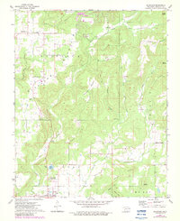
1972 Map of Blackgum
USGS Topo · Published 1983About this map
Blackgum Mountain and the surrounding peaks dominate this landscape in eastern Oklahoma during the early 1970s and 1980s. The area around Vian shows a transition from high ridges to more settled valleys where agricultural and residential development clustered. Local history is deeply embedded in the terrain, evidenced by several family or community burial grounds including the Cherokee-McCoy Cem and Barnisky Cem.
Find a feature on this map
37 named features on this map. Tap any name to fly to it.
Don’t see what you’re looking for? This feature index may not catch every label — zoom into the map to look around manually.
Map Details
Editions of this 1972 Blackgum Map
4 editions found
Other maps of this area

1898 · Tahlequah
USGS Topo · 1:125,000

1900 · Sansbois
USGS Topo · 1:125,000

1900 · Sallisaw
USGS Topo · 1:125,000

1901 · Muscogee
USGS Topo · 1:125,000

1901 · Tahlequah
USGS Topo · 1:125,000

1905 · Muscogee
USGS Topo · 1:125,000

1905 · Tahlequah
USGS Topo · 1:125,000

1909 · Sans Bois
USGS Topo · 1:125,000

1911 · Sallisaw
USGS Topo · 1:125,000

1911 · Sansbois
USGS Topo · 1:125,000