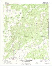
1972 Map of Blackgum
USGS Topo · Published 1974About this map
Vian Creek and Pinhook Creek carve through the prominent uplands of Blackgum Mountain and Marble Mountain in this early 1970s topographic study. The landscape is defined by its series of named heights, including Chuculate Mountain, Jackson Mountain, and Anderson Mountain, which overlook small, dispersed settlements like Box and Pinhook Corners. The area south of the primary ridgelines is anchored by Vian Lake and its adjacent Picnic Area, a center for local recreation near the town of Vian.
Find a feature on this map
39 named features on this map. Tap any name to fly to it.
Don’t see what you’re looking for? This feature index may not catch every label — zoom into the map to look around manually.
Map Details
Editions of this 1972 Blackgum Map
4 editions found
Other maps of this area

1898 · Tahlequah
USGS Topo · 1:125,000

1900 · Sansbois
USGS Topo · 1:125,000

1900 · Sallisaw
USGS Topo · 1:125,000

1901 · Muscogee
USGS Topo · 1:125,000

1901 · Tahlequah
USGS Topo · 1:125,000

1905 · Muscogee
USGS Topo · 1:125,000

1905 · Tahlequah
USGS Topo · 1:125,000

1909 · Sans Bois
USGS Topo · 1:125,000

1911 · Sallisaw
USGS Topo · 1:125,000

1911 · Sansbois
USGS Topo · 1:125,000