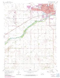
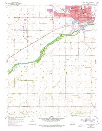
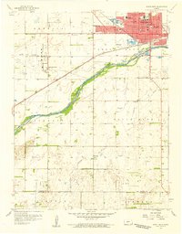
1958 Map of Great Bend
USGS Topo · Published 1983About this map
The Arkansas River carves a wide arc through Barton County, defining the growth of Great Bend and its surrounding agricultural townships. This mid-century survey reveals a thriving regional hub, concentrated north of the river and anchored by the Court House and a dense network of local schools including Lincoln Sch, Central Sch, and Riley Sch. The industrial and transportation identity of the area is evident in the alignment of the Atchison Topeka and Santa Fe railroad and the expansive Great Bend Municipal Airport to the west. South of the river, the landscape shifts toward rural sections in South Bend and Liberty townships, where Antelope Creek meanders through oil fields marked by numerous Oil Wells. Local landmarks such as the Great Bend Cemetery, the Drive-in Theater, and the St Rose Hospital provide specific touchpoints for genealogical and local history research.
Find a feature on this map
41 named features on this map. Tap any name to fly to it.
Don’t see what you’re looking for? This feature index may not catch every label — zoom into the map to look around manually.
Map Details
Editions of this 1958 Great Bend Map
3 editions found
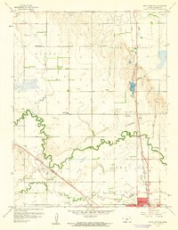
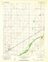
Other maps of this area

1891 · Great Bend
USGS Topo · 1:125,000

1893 · Great Bend
USGS Topo · 1:125,000

1955 · Great Bend
USGS Topo · 1:250,000
1956 · Ellinwood NW
USGS Topo · 1:24,000

1957 · Great Bend
USGS Topo · 1:250,000
1957 · Ellinwood SW
USGS Topo · 1:24,000

1958 · Great Bend
USGS Topo · 1:250,000
1958 · Great Bend
USGS Topo · 1:24,000
1959 · Great Bend NE
USGS Topo · 1:24,000
1960 · Pawnee Rock
USGS Topo · 1:24,000