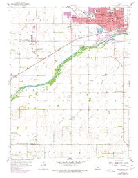
1958 Map of Great Bend
USGS Topo · Published 1977About this map
Great Bend dominates the northern edge of this landscape, its urban grid defined by a dense concentration of civic institutions and schools like Harrison Jr High Sch and St Rose Hospital. The Arkansas River flows through the center, flanked by an extensive Levee system that protects the developing town from the shifting sands and seasonal flows of the riverbed. South of the river, the terrain transitions into the petroleum-rich Buffalo Field, where numerous Oil Wells are scattered across the township lines of Liberty and South Bend. This 1950s survey shows the city's growth toward the Great Bend Airport and the presence of rural landmarks such as the Shady Grove Sch and Chaffee Sch, illustrating the intersection of Kansas agricultural life and the mid-century energy boom.
Find a feature on this map
37 named features on this map. Tap any name to fly to it.
Don’t see what you’re looking for? This feature index may not catch every label — zoom into the map to look around manually.
Map Details
Editions of this 1958 Great Bend Map
3 editions found
Other maps of this area

1891 · Great Bend
USGS Topo · 1:125,000

1893 · Great Bend
USGS Topo · 1:125,000

1955 · Great Bend
USGS Topo · 1:250,000

1956 · Ellinwood NW
USGS Topo · 1:24,000

1957 · Great Bend
USGS Topo · 1:250,000

1957 · Ellinwood SW
USGS Topo · 1:24,000

1958 · Great Bend
USGS Topo · 1:250,000

1958 · Great Bend
USGS Topo · 1:24,000

1959 · Great Bend NE
USGS Topo · 1:24,000

1960 · Pawnee Rock
USGS Topo · 1:24,000