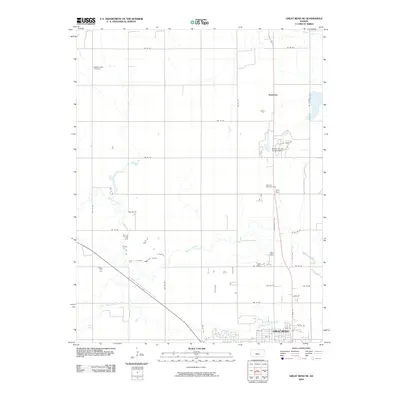
2009 Map of Great Bend NE
USGS Topo · Published 2009About this map
Great Bend serves as the focal point of this North Central Kansas landscape, where the northern residential and industrial expansion of the city meets the section-line roads of the agricultural plains. The map records a complex hydrological system defined by the meandering courses of Walnut Creek, Dry Walnut Creek, and Blood Creek as they converge toward the Arkansas River valley. Notable infrastructure includes the Barton County Fairgrounds and the Dent Spur rail feature, highlighting the area's role as a regional hub for commerce and community gatherings. Local heritage and genealogy interests are anchored by the Walnut Valley Cemetery in the northwest and Hillcrest Memorial Park near the city center. The settlement at Kanbrick stands north of the main city, marking the transition from urban streets like N Washington Ave to the vast grid of rural routes such as NW 90 Rd.
Find a feature on this map
38 named features on this map. Tap any name to fly to it.
Don’t see what you’re looking for? This feature index may not catch every label — zoom into the map to look around manually.
Map Details
Editions of this 2009 Great Bend NE Map
This is the sole edition of this map. No revisions or reprints were ever made.
Other maps of this area

1891 · Great Bend
USGS Topo · 1:125,000

1893 · Great Bend
USGS Topo · 1:125,000

1896 · Russell
USGS Topo · 1:125,000

1955 · Great Bend
USGS Topo · 1:250,000

1956 · Ellinwood NW
USGS Topo · 1:24,000

1957 · Great Bend
USGS Topo · 1:250,000

1957 · Ellinwood SW
USGS Topo · 1:24,000

1958 · Great Bend
USGS Topo · 1:250,000

1958 · Great Bend
USGS Topo · 1:24,000

1959 · Great Bend NE
USGS Topo · 1:24,000