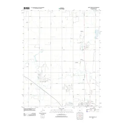
2012 Map of Great Bend NE
USGS Topo · Published 2012About this map
Walnut Creek and Dry Walnut Creek define the drainage of this Kansas landscape just northeast of the regional center. This 2012 survey shows the transition from the gridded rural farmsteads of the county to the developing northern edges of Great Bend. The northern extent includes the small settlement of Kanbrick and the Walnut Valley Cemetery, while the southern reaches show more modern civic developments. Significant local landmarks such as the Barton County Fairgrounds and Barton Lake sit near the recreational corridor of the Barton Golf Course. Genealogists may find value in the clearly marked locations of Hillcrest Memorial Park and Golden Belt Memorial Park, which serve the local community. The map also captures the organized layout of the Wetlands at Great Bend Aquatic Facility, reflecting contemporary land use focused on both environmental management and local recreation.
Find a feature on this map
43 named features on this map. Tap any name to fly to it.
Don’t see what you’re looking for? This feature index may not catch every label — zoom into the map to look around manually.
Map Details
Editions of this 2012 Great Bend NE Map
This is the sole edition of this map. No revisions or reprints were ever made.
Other maps of this area

1891 · Great Bend
USGS Topo · 1:125,000

1893 · Great Bend
USGS Topo · 1:125,000

1896 · Russell
USGS Topo · 1:125,000

1955 · Great Bend
USGS Topo · 1:250,000

1956 · Ellinwood NW
USGS Topo · 1:24,000

1957 · Great Bend
USGS Topo · 1:250,000

1957 · Ellinwood SW
USGS Topo · 1:24,000

1958 · Great Bend
USGS Topo · 1:250,000

1958 · Great Bend
USGS Topo · 1:24,000

1959 · Great Bend NE
USGS Topo · 1:24,000