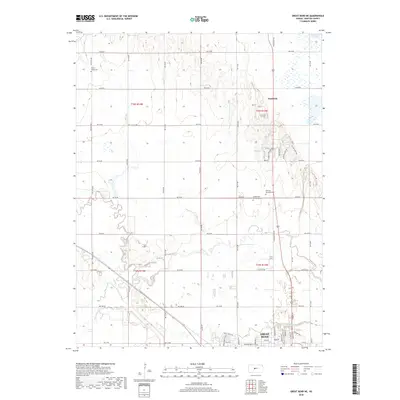
2018 Map of Great Bend NE
USGS Topo · Published 2018About this map
Great Bend and its northern outskirts are the focus of this 2018 survey, where the prairie landscape is defined by the winding paths of Walnut Cr and Dry Walnut Cr. The map details the transition from the city's residential streets—including Paseo Dr and Garmont Ave—into a structured agricultural grid. Significant local landmarks such as Hillcrest Memorial Park and Golden Belt Memorial Park sit near the city limits, while further north, the rural character is punctuated by the small settlement of Kanbrick. The hydrology of the region is well-represented by the course of Blood Cr and the presence of Barton Lake, reflecting a landscape managed for both drainage and recreation. This topographic study serves as a clear record of the modern intersection between Kansas river bottomlands and the expanding footprint of Barton County's seat.
Find a feature on this map
59 named features on this map. Tap any name to fly to it.
Don’t see what you’re looking for? This feature index may not catch every label — zoom into the map to look around manually.
Map Details
Editions of this 2018 Great Bend NE Map
This is the sole edition of this map. No revisions or reprints were ever made.
Other maps of this area

1891 · Great Bend
USGS Topo · 1:125,000

1893 · Great Bend
USGS Topo · 1:125,000

1896 · Russell
USGS Topo · 1:125,000

1955 · Great Bend
USGS Topo · 1:250,000

1956 · Ellinwood NW
USGS Topo · 1:24,000

1957 · Great Bend
USGS Topo · 1:250,000

1957 · Ellinwood SW
USGS Topo · 1:24,000

1958 · Great Bend
USGS Topo · 1:250,000

1958 · Great Bend
USGS Topo · 1:24,000

1959 · Great Bend NE
USGS Topo · 1:24,000