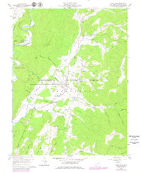
1960 Map of Green Bank
USGS Topo · Published 1979About this map
The National Radio Astronomy Observatory dominates this pocket of the West Virginia mountains, where the large-scale scientific facility exists alongside traditional rural settlements. The map illustrates the specialized infrastructure of the radio quiet zone, including multiple telescopes, an Antenna, and the Observatory Reservation Boundary that encloses much of the Deer Creek valley. Local life is centered in Green Bank and Arbovale, where a Hospital, High School, and Bank are tucked into the valley floor near the Chesapeake and Ohio railway line.
Find a feature on this map
54 named features on this map. Tap any name to fly to it.
Don’t see what you’re looking for? This feature index may not catch every label — zoom into the map to look around manually.
Map Details
Editions of this 1960 Green Bank Map
Other maps of this area

1889 · Beverly
USGS Topo · 1:125,000

1892 · Beverly
USGS Topo · 1:125,000

1901 · Monterey
USGS Topo · 1:125,000

1922 · Spruce Knob
USGS Topo · 1:48,000

1922 · Cass
USGS Topo · 1:48,000

1922 · Durbin
USGS Topo · 1:48,000

1924 · Cass
USGS Topo · 1:62,500

1924 · Durbin
USGS Topo · 1:62,500

1924 · Spruce Knob
USGS Topo · 1:62,500

1941 · Monterey
USGS Topo · 1:62,500