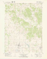
1979 Map of Green City
USGS Topo · Published 1979About this map
Green City and Green Castle anchor this late 1970s landscape in Sullivan County, Missouri, where the transition from rail to road is etched into the terrain. The presence of an Old Railroad Grade running through the southern half of the quadrangle marks the path of former commerce, now superseded by the local road network. The rural character of Penn and Buchanan townships is defined by several cemeteries, including Hawkeye Cem and Mt Olive Cem, which serve as vital landmarks for genealogists tracing local family roots. The hydrology is dominated by the northward-flowing Spring Creek and the Mussel Fork, while Widmark Airport and a designated Picnic Area near the town center show the community's mid-century infrastructure. A large reservoir features a spillway near the eastern edge, highlighting local water management in this agricultural region.
Find a feature on this map
20 named features on this map. Tap any name to fly to it.
Don’t see what you’re looking for? This feature index may not catch every label — zoom into the map to look around manually.
Map Details
Editions of this 1979 Green City Map
This is the sole edition of this map. No revisions or reprints were ever made.
Other maps of this area

1912 · Green City
USGS Topo · 1:62,500

1914 · Green City
USGS Topo · 1:62,500

1954 · Centerville
USGS Topo · 1:250,000

1957 · Centerville
USGS Topo · 1:250,000

1958 · Centerville
USGS Topo · 1:250,000

1963 · Pure Air
USGS Topo · 1:24,000
1963 · Mystic
USGS Topo · 1:24,000
1964 · Milan East
USGS Topo · 1:24,000

1964 · Unionville West
USGS Topo · 1:24,000
1964 · Pollock
USGS Topo · 1:24,000