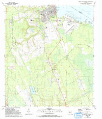
1991 Map of Green Cove Springs
USGS Topo · Published 1991About this map
Green Cove Springs sits prominently along the St Johns River, serving as a primary hub for this riverside region during the early 1990s. The landscape is defined by the intersection of water and industry, with the Shands Bridge connecting Clay and St. Johns Counties and large-scale features like the Reynolds Airpark and Industrial Waste Ponds south of town. Rural communities such as Virginia Village and Leno are connected by a network of local roads including Moody Road and Bellamy Road.
Find a feature on this map
47 named features on this map. Tap any name to fly to it.
Don’t see what you’re looking for? This feature index may not catch every label — zoom into the map to look around manually.
Map Details
Editions of this 1991 Green Cove Springs Map
This is the sole edition of this map. No revisions or reprints were ever made.
Other maps of this area

1917 · Orange Park
USGS Topo · 1:62,500

1918 · Middleburg
USGS Topo · 1:62,500

1918 · Orange Park
USGS Topo · 1:62,500

1941 · Middleburg
USGS Topo · 1:62,500

1942 · Ates Creek
USGS Topo · 1:62,500

1947 · Bostwick
USGS Topo · 1:50,000

1948 · Jacksonville
USGS Topo · 1:250,000

1949 · Rice Creek
USGS Topo · 1:24,000

1949 · Bostwick
USGS Topo · 1:24,000

1949 · Green Cove Springs
USGS Topo · 1:24,000