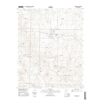
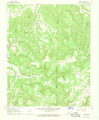
2017 Map of Green Forest
USGS Topo · Published 2017About this map
Green Forest serves as the primary hub in this portion of Carroll County, where the transition from municipal streets to the high ridges of the Ozarks is sharply defined. The town is surrounded by a significant concentration of family and community burial grounds, including Glenwood Cem, Norris Cem, and the Pickens Cem near the town center. To the south, the terrain becomes increasingly complex as the drainage of Osage Creek and Yocum Cr carves out a series of deep hollows and prominent peaks. High points like Pinnacle, Mill Mtn, and Jackson Mtn overlook narrow valleys such as Hoppins Hollow and Schriborough Canyon. The small community of Rule sits at a crossroads in the southern highlands, while the northern landscape is marked by the distinct passage through Jennings Gap. This topography reveals how the historical road network was dictated by the steep elevations of Anderson Mtn and Crystal Mtn.
Find a feature on this map
122 named features on this map. Tap any name to fly to it.
Don’t see what you’re looking for? This feature index may not catch every label — zoom into the map to look around manually.
Map Details
Editions of this 2017 Green Forest Map
This is the sole edition of this map. No revisions or reprints were ever made.
Other maps of this area
1900 · Eureka Springs
USGS Topo · 1:125,000
1901 · Eureka Springs
USGS Topo · 1:125,000
1904 · Harrison
USGS Topo · 1:125,000
1905 · Harrison
USGS Topo · 1:125,000

1945 · Harrison
USGS Topo · 1:250,000

1949 · Harrison
USGS Topo · 1:250,000
1954 · Harrison
USGS Topo · 1:250,000
1958 · Harrison
USGS Topo · 1:250,000
1964 · Harrison
USGS Topo · 1:250,000
1968 · Osage NE
USGS Topo · 1:24,000