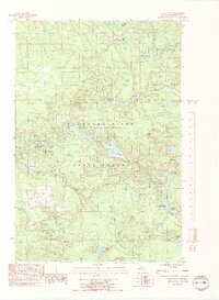
1986 Map of Green Hills
USGS Topo · Published 1991About this map
The Escanaba River State Forest dominates this landscape in Marquette County, defined by a dense network of waterways and the eponymous Green Hills. Two major water systems, the Middle Branch Escanaba River and the main Escanaba River, navigate through the center of the sheet, supported by numerous smaller tributaries like Bryan Creek and Flopper Creek. The terrain is punctuated by a variety of glacial lakes, including the prominent Voelker Lake, East Voelker Lake, and Big Bass Lake.
Find a feature on this map
32 named features on this map. Tap any name to fly to it.
Don’t see what you’re looking for? This feature index may not catch every label — zoom into the map to look around manually.
Map Details
Editions of this 1986 Green Hills Map
3 editions found
Other maps of this area

1952 · Ishpeming
USGS Topo · 1:62,500

1952 · Ishpeming
USGS Topo · 1:24,000

1952 · Palmer
USGS Topo · 1:24,000

1955 · Ralph NE
USGS Topo · 1:24,000

1955 · Greenwood
USGS Topo · 1:24,000

1955 · Republic
USGS Topo · 1:62,500

1955 · Ralph
USGS Topo · 1:62,500

1957 · Northland
USGS Topo · 1:62,500

1958 · Marquette
USGS Topo · 1:250,000

1960 · Marquette
USGS Topo · 1:250,000