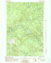
1986 Map of Green Hills
USGS Topo · Published 1992About this map
The Escanaba River and its many tributaries carve through the glaciated terrain of central Marquette County, defining a landscape dominated by the Escanaba River State Forest. This mid-1980s topography reveals a dense network of water bodies, from the larger Voelker Lake and Big Bass Lake to smaller basins like Kidney Lake and Horseshoe Lake. The drainage patterns of Bryan Creek and Eleven Creek suggest the complex marshy wetlands typical of Michigan's Upper Peninsula.
Find a feature on this map
31 named features on this map. Tap any name to fly to it.
Don’t see what you’re looking for? This feature index may not catch every label — zoom into the map to look around manually.
Map Details
Editions of this 1986 Green Hills Map
3 editions found
Other maps of this area

1952 · Ishpeming
USGS Topo · 1:62,500

1952 · Ishpeming
USGS Topo · 1:24,000

1952 · Palmer
USGS Topo · 1:24,000

1955 · Ralph NE
USGS Topo · 1:24,000

1955 · Greenwood
USGS Topo · 1:24,000

1955 · Republic
USGS Topo · 1:62,500

1955 · Ralph
USGS Topo · 1:62,500

1957 · Northland
USGS Topo · 1:62,500

1958 · Marquette
USGS Topo · 1:250,000

1960 · Marquette
USGS Topo · 1:250,000