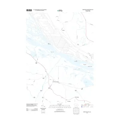
2013 Map of Green Island
USGS Topo · Published 2013About this map
The Mississippi River creates a complex system of backwaters, sloughs, and islands at the border of Iowa and Illinois. The convergence of the Maquoketa River and the Apple River into the Mississippi valley dominates the landscape, defining a region where water management and river navigation are central to life. Small settlements like Green Island and Whitton sit along the valley floor, while names like Reeceville and Twin Springs indicate localized development near the bluffs.
Find a feature on this map
66 named features on this map. Tap any name to fly to it.
Don’t see what you’re looking for? This feature index may not catch every label — zoom into the map to look around manually.
Map Details
Editions of this 2013 Green Island Map
This is the sole edition of this map. No revisions or reprints were ever made.
Other maps of this area

1892 · Savanna
USGS Topo · 1:62,500

1911 · Elizabeth
USGS Topo · 1:62,500

1911 · Galena
USGS Topo · 1:62,500

1913 · Galena
USGS Topo · 1:62,500

1935 · Miles
USGS Topo · 1:62,500

1936 · Elizabeth
USGS Topo · 1:62,500

1941 · Miles
USGS Topo · 1:62,500

1952 · Savanna
USGS Topo · 1:62,500

1953 · Blackhawk
USGS Topo · 1:24,000

1953 · Green Island
USGS Topo · 1:24,000