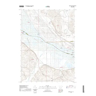
2018 Map of Green Island
USGS Topo · Published 2018About this map
Green Island lies at the complex confluence of the Mississippi River, the Maquoketa River, and the Apple River, a landscape defined by an intricate network of sloughs and backwaters. This 2018 survey detail shows the persistent settlement patterns along the river bluffs and valleys, from the town of Hanover in the north to the smaller communities of Reeceville and Twin Springs in the south. The terrain is marked by numerous named hollows like Schlect Hollow and Friday Hollow, which dictate the local road network. Local heritage is preserved at sites such as Reeceville Cem and Lost Mound Cem, while the river itself is dotted with named landforms including Morse Island, Kennedy Bar, and Railroad Island. The map illustrates the geographical boundary where Illinois and Iowa meet, showing how the shifting waterways and islands like Island Number 254 have historically shaped the regional borders.
Find a feature on this map
75 named features on this map. Tap any name to fly to it.
Don’t see what you’re looking for? This feature index may not catch every label — zoom into the map to look around manually.
Map Details
Editions of this 2018 Green Island Map
This is the sole edition of this map. No revisions or reprints were ever made.
Other maps of this area

1892 · Savanna
USGS Topo · 1:62,500

1911 · Elizabeth
USGS Topo · 1:62,500

1911 · Galena
USGS Topo · 1:62,500

1913 · Galena
USGS Topo · 1:62,500

1935 · Miles
USGS Topo · 1:62,500

1936 · Elizabeth
USGS Topo · 1:62,500

1941 · Miles
USGS Topo · 1:62,500

1952 · Savanna
USGS Topo · 1:62,500

1953 · Blackhawk
USGS Topo · 1:24,000

1953 · Green Island
USGS Topo · 1:24,000