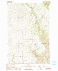
1990 Map of Green Knob
USGS Topo · Published 1990About this map
The Nez Perce Indian Reservation Boundary cuts across this 1990 survey, marking a clear division in the high country between Latah and Nez Perce counties. The landscape is defined by the deep drainage systems of the Potlatch River and its tributaries, including Little Potlatch Creek and Middle Potlatch Cr. These watercourses carve through prominent uplands like Fix Ridge and the namesake Green Knob peak.
Find a feature on this map
13 named features on this map. Tap any name to fly to it.
Don’t see what you’re looking for? This feature index may not catch every label — zoom into the map to look around manually.
Map Details
Editions of this 1990 Green Knob Map
This is the sole edition of this map. No revisions or reprints were ever made.
Other maps of this area

1955 · Pullman
USGS Topo · 1:250,000

1958 · Pullman
USGS Topo · 1:250,000

1958 · Lapwai
USGS Topo · 1:24,000

1958 · Lewiston Orchards North
USGS Topo · 1:24,000

1958 · Lewiston Orchards
USGS Topo · 1:62,500

1958 · Culdesac
USGS Topo · 1:62,500

1960 · Troy
USGS Topo · 1:24,000

1960 · Moscow East
USGS Topo · 1:24,000

1961 · Kendrick
USGS Topo · 1:62,500

1961 · Moscow
USGS Topo · 1:62,500