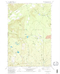
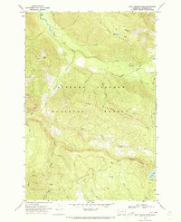
1970 Map of Green Mountain
USGS Topo · Published 1980About this map
The high backcountry of Gifford Pinchot National Forest defines this 1970 study, which captures a landscape shaped by glacial waters and volcanic activity. The geography is anchored by Green Mountain and the prominent Lava flows to the east, with drainage systems including the Cispus River and the Muddy Fork. This era shows a well-established network of forest management and recreational access, featuring the Cat Creek Guard Station and several remote campsites like Killen Creek Campground and Olallie Lake Campground.
Find a feature on this map
47 named features on this map. Tap any name to fly to it.
Don’t see what you’re looking for? This feature index may not catch every label — zoom into the map to look around manually.
Map Details
Editions of this 1970 Green Mountain Map
2 editions found
Other maps of this area

1904 · Mount Adams
USGS Topo · 1:125,000

1907 · Mount Adams
USGS Topo · 1:125,000

1926 · Steamboat Mtn
USGS Topo · 1:125,000

1931 · Steamboat Mtn
USGS Topo · 1:125,000

1950 · Yakima
USGS Topo · 1:250,000

1958 · Yakima
USGS Topo · 1:250,000

1961 · Yakima
USGS Topo · 1:250,000
1970 · Hamilton Buttes
USGS Topo · 1:24,000
1970 · Blue Lake
USGS Topo · 1:24,000
1970 · East Canyon Ridge
USGS Topo · 1:24,000