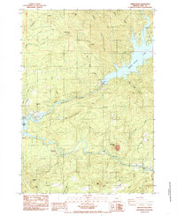
1984 Map of Green Peter
USGS Topo · Published 1985About this map
Green Peter Dam anchors this mid-1980s landscape in Linn County, where the impounded Green Peter Lake meets the Middle Santiam River. The area is characterized by heavy industrial and recreational use, shown through numerous quarries, borrow pits, and transmission lines that power the region. Shoreline developments like Sunnyside Park and Lewis Cr Park sit near Greenhorn Hill, marking the transition from the river valley to the steep timbered slopes of Hufford Ridge. Along the South Santiam River, small-scale details like the Meneares Bend Campground, a quiet cemetery, and the Short Bridge offer points of interest for local historians and genealogists. The presence of gaging stations and multiple parks highlights the importance of water management and forest recreation during this era of Oregon's development.
Find a feature on this map
45 named features on this map. Tap any name to fly to it.
Don’t see what you’re looking for? This feature index may not catch every label — zoom into the map to look around manually.
Map Details
Editions of this 1984 Green Peter Map
This is the sole edition of this map. No revisions or reprints were ever made.
Other maps of this area

1929 · Mill City
USGS Topo · 1:125,000

1934 · Mc Kenzie Bridge
USGS Topo · 1:96,000

1940 · Mc Kenzie Bridge
USGS Topo · 1:125,000

1951 · Sweet Home
USGS Topo · 1:62,500

1951 · Snow Peak
USGS Topo · 1:62,500

1953 · Salem
USGS Topo · 1:250,000

1954 · Salem
USGS Topo · 1:250,000

1955 · Cascadia
USGS Topo · 1:62,500

1956 · Quartzville
USGS Topo · 1:62,500

1960 · Salem
USGS Topo · 1:250,000