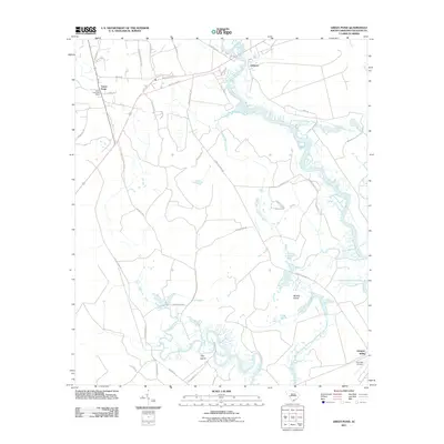
2011 Map of Green Pond
USGS Topo · Published 2011About this map
Green Pond and the surrounding Lowcountry of Colleton County are defined by a complex network of waterways and tidal islands. The Ashepoo River meanders through the landscape, feeding into a maze of smaller tributaries like Deer Creek and Social Hall Creek. This coastal environment features prominent landforms such as Minkey Island and Tilly Island, illustrating the intersection of the Chehaw River with the marshy terrain.
Find a feature on this map
40 named features on this map. Tap any name to fly to it.
Don’t see what you’re looking for? This feature index may not catch every label — zoom into the map to look around manually.
Map Details
Editions of this 2011 Green Pond Map
This is the sole edition of this map. No revisions or reprints were ever made.
Other maps of this area

1918 · Walterboro
USGS Topo · 1:62,500

1918 · Green Pond
USGS Topo · 1:62,500

1918 · Cottageville
USGS Topo · 1:62,500

1919 · Edisto Island
USGS Topo · 1:62,500

1943 · Cottageville
USGS Topo · 1:62,500

1943 · Edisto Island
USGS Topo · 1:62,500

1943 · Green Pond
USGS Topo · 1:62,500

1943 · Walterboro
USGS Topo · 1:62,500

1947 · Savannah
USGS Topo · 1:250,000

1948 · Savannah
USGS Topo · 1:250,000