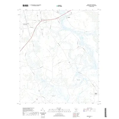
2020 Map of Green Pond
USGS Topo · Published 2020About this map
The Ashepoo River and Chehaw River dominate this coastal South Carolina landscape, carving through a complex network of wetlands and tidal passages. This low-country terrain is defined by landforms like Minkey Island and Tilly Island, where the drainage of Social Hall Creek and Deer Creek meets the river systems. The settlement pattern is sparse, concentrated at Green Pond and the river-adjacent locations of Ashepoo and Ashepoo Siding. Modern transportation infrastructure, most notably the Ace Basin Pkwy, cuts across the northwestern portion of the map, providing a stark contrast to the winding local roads like Bennetts Point Rd and Lavington East Ln that trace the historical edges of the marshes. The map documents a landscape where traditional river-based geography still dictates the placement of homes and industry.
Find a feature on this map
43 named features on this map. Tap any name to fly to it.
Don’t see what you’re looking for? This feature index may not catch every label — zoom into the map to look around manually.
Map Details
Editions of this 2020 Green Pond Map
This is the sole edition of this map. No revisions or reprints were ever made.
Other maps of this area

1918 · Walterboro
USGS Topo · 1:62,500

1918 · Green Pond
USGS Topo · 1:62,500

1918 · Cottageville
USGS Topo · 1:62,500

1919 · Edisto Island
USGS Topo · 1:62,500

1943 · Cottageville
USGS Topo · 1:62,500

1943 · Edisto Island
USGS Topo · 1:62,500

1943 · Green Pond
USGS Topo · 1:62,500

1943 · Walterboro
USGS Topo · 1:62,500

1947 · Savannah
USGS Topo · 1:250,000

1948 · Savannah
USGS Topo · 1:250,000