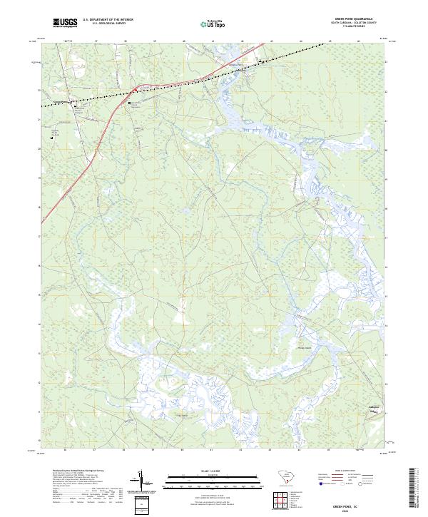
2024 Map of Green Pond
USGS Topo · Published 2024About this map
The small unincorporated community of Green Pond and the river-oriented settlement of Ashepoo define this coastal South Carolina landscape. Established along the ACE Basin Pkwy, the area maintains a distinct spiritual geography, evidenced by several local congregations and their associated burial grounds, including the Green Pond Church Graveyard, Heavenly Church Graveyard, and Mount Olive Church Graveyard. These sites provide significant points of interest for genealogists tracing family roots through Colleton County.
Find a feature on this map
42 named features on this map. Tap any name to fly to it.
Don’t see what you’re looking for? This feature index may not catch every label — zoom into the map to look around manually.
Map Details
Editions of this 2024 Green Pond Map
This is the sole edition of this map. No revisions or reprints were ever made.
Other maps of this area

1918 · Walterboro
USGS Topo · 1:62,500

1918 · Green Pond
USGS Topo · 1:62,500

1918 · Cottageville
USGS Topo · 1:62,500

1919 · Edisto Island
USGS Topo · 1:62,500

1943 · Cottageville
USGS Topo · 1:62,500

1943 · Edisto Island
USGS Topo · 1:62,500

1943 · Green Pond
USGS Topo · 1:62,500

1943 · Walterboro
USGS Topo · 1:62,500

1947 · Savannah
USGS Topo · 1:250,000

1948 · Savannah
USGS Topo · 1:250,000