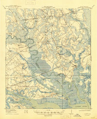
1918 Map of Green Pond
USGS Topo · Published 1945About this map
The Combahee River and Ashepoo River dominate this Lowcountry coastal landscape, threading through a network of tidal creeks and marshlands. Along the riverbanks and rail lines, communities like Whitehall and Green Pond serve as hubs for a region defined by its waterway connectivity and early 20th-century industry, evidenced by the Lumber Line and the Ashepoo Siding. The map reveals a dense social fabric through its numerous rural congregations, including the First African Church, Broom Bottom Church, and Mount Sinai Church.
Find a feature on this map
70 named features on this map. Tap any name to fly to it.
Don’t see what you’re looking for? This feature index may not catch every label — zoom into the map to look around manually.
Map Details
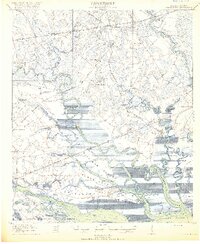
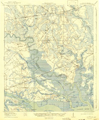
Editions of this 1918 Green Pond Map
4 editions found
Other maps of this area

1918 · Walterboro
USGS Topo · 1:62,500

1918 · Green Pond
USGS Topo · 1:62,500

1918 · Yemassee
USGS Topo · 1:62,500

1918 · Cottageville
USGS Topo · 1:62,500

1919 · Edisto Island
USGS Topo · 1:62,500

1919 · Cummings
USGS Topo · 1:62,500

1920 · Okatie
USGS Topo · 1:62,500

1920 · St. Helena Sound
USGS Topo · 1:62,500

1942 · Okatie
USGS Topo · 1:62,500

1943 · Cottageville
USGS Topo · 1:62,500