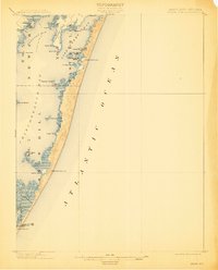
1901 Map of Green Run
USGS Topo · Published 1912About this map
The coastal barrier islands and estuaries of the Delmarva Peninsula are captured in high detail here, reflecting the landscape as it appeared during the 1900 survey. Life-Saving Stations, including North Beach L.S.S. and Green Run Inlet L.S.S., stand as vital maritime outposts along the narrow strand separating the Atlantic Ocean from the inner bays. The map reveals the intricate shoreline of Sinepuxent Bay and Chincoteague Bay, punctuated by family-named landmarks and hunting grounds like Winter Quarter and Whittington Point. Points of transit and trade are marked at Scotts Landing and across the peninsulas of Newport Neck and Sinepuxent Neck. This study highlights the ephemeral nature of the coast before modern development, documenting small islands and marshes such as Tingles Island and Lumber Marsh that define this saltwater environment.
Find a feature on this map
37 named features on this map. Tap any name to fly to it.
Don’t see what you’re looking for? This feature index may not catch every label — zoom into the map to look around manually.
Map Details
Editions of this 1901 Green Run Map
4 editions found
Other maps of this area

1901 · Snow Hill
USGS Topo · 1:62,500

1901 · Green Run
USGS Topo · 1:62,500

1901 · Ocean City
USGS Topo · 1:62,500

1902 · Pittsville
USGS Topo · 1:62,500

1938 · Green Run
USGS Topo · 1:62,500

1942 · Ocean City
USGS Topo · 1:62,500

1942 · Chincoteague East
USGS Topo · 1:24,000

1942 · Ninepin
USGS Topo · 1:24,000

1942 · Ocean City
USGS Topo · 1:24,000

1942 · Tingles Island
USGS Topo · 1:24,000