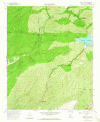
1958 Map of Green Valley
USGS Topo · Published 1964About this map
Bouquet Reservoir dominates the eastern landscape of this mountain survey, secured by the Bouquet Canyon Dam. This mid-century view captures the infrastructure of the Los Angeles City Aqueduct, which threads through the canyons alongside the San Francisquito Powerhouse No 1. The terrain is defined by the steep ridges of Sierra Pelona and the San Francisquito Canyon, where small settlements like Green Valley and Road Camp No 7 provide the only significant population centers. Resource extraction and forest management are evident through the presence of the California Mine, several quarries, and the Bouquet Guard Station. This map highlights a transitional period where utility infrastructure and recreational sites like the South Portal Campground integrated into the traditional mining and ranching landscapes of northern Los Angeles County.
Find a feature on this map
49 named features on this map. Tap any name to fly to it.
Don’t see what you’re looking for? This feature index may not catch every label — zoom into the map to look around manually.
Map Details
Editions of this 1958 Green Valley Map
3 editions found
Other maps of this area

1900 · Fernando
USGS Topo · 1:62,500

1901 · Southern California Sheet No. 1
USGS Topo · 1:250,000

1903 · Tejon
USGS Topo · 1:125,000

1903 · Camulos
USGS Topo · 1:125,000

1903 · Santa Susana
USGS Topo · 1:62,500

1904 · Southern California Sheet No. 1
USGS Topo · 1:250,000

1915 · Elizabeth Lake
USGS Topo · 1:125,000

1917 · Elizabeth Lake
USGS Topo · 1:125,000

1929 · Saugus
USGS Topo · 1:24,000

1929 · Lang
USGS Topo · 1:24,000