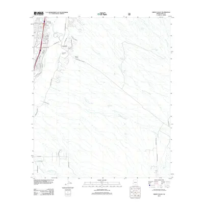
2012 Map of Green Valley
USGS Topo · Published 2012About this map
The Continental settlement area along the Santa Cruz River defines this portion of the Pima County landscape, where modern infrastructure meets a complex network of seasonal watercourses. Commercial and community life centers on the western edge of the map, marked by the Continental Airport, the Canoa Hills Golf Course, and the local Po. To the east, the terrain rises sharply into a series of named drainages, including Sawmill Canyon Wash and Florida Canyon Wash, which dominate the arid geography. This 2012 survey captures the community as residential development began to push further into the alluvial fans. For local historians, the Continental Cem near S Campbell Rd remains a significant landmark of the area's established heritage, while the presence of various stock tanks like Muhlenbergia Tank and Juniper Tank points to the region's enduring ranching and land management practices.
Find a feature on this map
54 named features on this map. Tap any name to fly to it.
Don’t see what you’re looking for? This feature index may not catch every label — zoom into the map to look around manually.
Map Details
Editions of this 2012 Green Valley Map
This is the sole edition of this map. No revisions or reprints were ever made.
Other maps of this area

1904 · Patagonia
USGS Topo · 1:125,000

1905 · Patagonia
USGS Topo · 1:125,000

1920 · Arivaca
USGS Topo · 1:125,000

1922 · Agus Caliente
USGS Topo · 1:62,500

1925 · Samaniego Peak
USGS Topo · 1:62,500

1926 · Helvetia
USGS Topo · 1:62,500

1939 · Twin Buttes
USGS Topo · 1:62,500

1939 · Tubac
USGS Topo · 1:62,500

1941 · Twin Buttes
USGS Topo · 1:62,500

1943 · Tubac
USGS Topo · 1:62,500