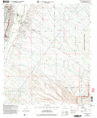
2004 Map of Green Valley
USGS Topo · Published 2006About this map
Residential development in the Sonoran Desert expands eastward toward the mountains on this early 21st-century survey of Green Valley and Continental. The landscape is defined by the ephemeral Santa Cruz River, where a Landing Strip and a Gaging Sta sit near the crossing of Continental Road. Local education and community life center on the Continental Sch and the United Methodist Community Ch, while newer neighborhoods like Madera Shadows (Subdivision) and Pasadera (Subdivision) begin to climb the alluvial fans.
Find a feature on this map
39 named features on this map. Tap any name to fly to it.
Don’t see what you’re looking for? This feature index may not catch every label — zoom into the map to look around manually.
Map Details
Editions of this 2004 Green Valley Map
This is the sole edition of this map. No revisions or reprints were ever made.
Other maps of this area

1904 · Patagonia
USGS Topo · 1:125,000

1905 · Patagonia
USGS Topo · 1:125,000

1920 · Arivaca
USGS Topo · 1:125,000

1922 · Agus Caliente
USGS Topo · 1:62,500

1925 · Samaniego Peak
USGS Topo · 1:62,500

1926 · Helvetia
USGS Topo · 1:62,500

1939 · Twin Buttes
USGS Topo · 1:62,500

1939 · Tubac
USGS Topo · 1:62,500

1941 · Twin Buttes
USGS Topo · 1:62,500

1943 · Tubac
USGS Topo · 1:62,500