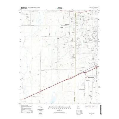
2014 Map of Greenbrier
USGS Topo · Published 2014About this map
Oakland and Burgreen Gin sit at the intersection of agricultural roots and modern suburban expansion in this northern Alabama landscape. The area is defined by a complex network of springs and branches, including Tribble Spring, Withers Spring, and Moss Spring, which historically fed the local farmsteads. To the south, the terrain descends toward the vast Wheeler Lake and the wetlands of Limestone Slough, while the northern reaches are punctuated by Bryan Hill. The transition from rural crossroad settlements like Greenbrier and Parker to established residential areas such as Madison, Rolling Woods, and Maplewood illustrates the 21st-century growth pattern of the region. Transportation remains a central theme, with Old Highway 20 and a prominent railway cutting through the lowlands, providing a clear view of the infrastructure connecting these communities to the larger Huntsville area.
Find a feature on this map
137 named features on this map. Tap any name to fly to it.
Don’t see what you’re looking for? This feature index may not catch every label — zoom into the map to look around manually.
Map Details
Editions of this 2014 Greenbrier Map
This is the sole edition of this map. No revisions or reprints were ever made.
Other maps of this area

1888 · Huntsville
USGS Topo · 1:125,000

1892 · Huntsville
USGS Topo · 1:125,000

1935 · Athens
USGS Topo · 1:24,000

1936 · Jeff
USGS Topo · 1:24,000

1936 · Capshaw
USGS Topo · 1:24,000

1936 · Triana
USGS Topo · 1:24,000

1936 · Madison
USGS Topo · 1:24,000

1936 · Decatur
USGS Topo · 1:24,000

1936 · Mason Ridge
USGS Topo · 1:24,000

1936 · Tanner
USGS Topo · 1:24,000