
1936 Map of Jeff
USGS Topo · Published 1936About this map
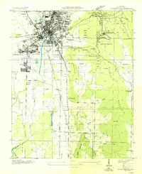
The Chickasaw Boundary cuts diagonally through the southern landscape of this 1936 survey, a tangible reminder of historic land cessions that defined Madison County. The area is characterized by small rural settlements and an extensive network of country institutions, notably Oakwood Junior College and numerous local schools like Monrovia Sch and Capshaw Sch. Topographical landmarks such as Capshaw Mtn, Burwell Mtn, and King Mountain rise above the drainage basins of Beaverdam Creek and Indian Creek. Infrastructure is marked by the Alabama Power Company Transmission Line and a system of industrial flumes near Monrovia. This survey, conducted by the Tennessee Valley Authority, captures the transition of northern Alabama as public works and electrification began reshaping the traditional agricultural communities of Jeff, Harvest, and Carter Store.
Find a feature on this map
39 named features on this map. Tap any name to fly to it.
Don’t see what you’re looking for? This feature index may not catch every label — zoom into the map to look around manually.
Map Details
Editions of this 1936 Jeff Map
This is the sole edition of this map. No revisions or reprints were ever made.
Other maps of this area

1888 · Huntsville
USGS Topo · 1:125,000

1892 · Huntsville
USGS Topo · 1:125,000

1936 · Capshaw
USGS Topo · 1:24,000

1936 · Madison
USGS Topo · 1:24,000

1936 · Meridianville
USGS Topo · 1:24,000

1936 · Fisk
USGS Topo · 1:24,000

1936 · Ardmore
USGS Topo · 1:24,000

1936 · Toney
USGS Topo · 1:24,000

1936 · Greenbrier
USGS Topo · 1:24,000
1936 · Huntsville
USGS Topo · 1:24,000