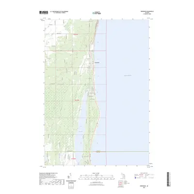
2023 Map of Greenbush
USGS Topo · Published 2023About this map
Lake Huron defines the eastern edge of this coastal Michigan landscape, where the community of Greenbush sits along the shoreline at the intersection of Main St and Co Hwy F-30. The map reveals a delicate hydrological balance between the Great Lake and the interior, characterized by the expansive Cedar Lake Swamp and the elongated basin of Cedar Lake. This 2023 survey provides a contemporary view of local infrastructure, including a network of named roads such as Poor Farm Rd and S Huron Shore Dr that service the shoreline residences and wooded tracts. The drainage of Phelan Creek in the southern portion of the quadrangle highlights the low-lying terrain typical of this Alcona County region, where residential development is concentrated primarily between the inland lakes and the Lake Huron coast.
Find a feature on this map
79 named features on this map. Tap any name to fly to it.
Don’t see what you’re looking for? This feature index may not catch every label — zoom into the map to look around manually.
Map Details
Editions of this 2023 Greenbush Map
This is the sole edition of this map. No revisions or reprints were ever made.
Other maps of this area

1954 · Tawas City
USGS Topo · 1:250,000

1958 · Tawas City
USGS Topo · 1:250,000

1959 · East Tawas
USGS Topo · 1:62,500

1959 · Harrisville
USGS Topo · 1:62,500

1983 · Hubbard Lake
USGS Topo · 1:100,000

1984 · Tawas City
USGS Topo · 1:100,000
1989 · Harrisville
USGS Topo · 1:24,000

1989 · Mikado
USGS Topo · 1:24,000
1989 · Lincoln
USGS Topo · 1:24,000
1989 · Greenbush
USGS Topo · 1:24,000