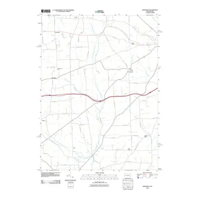
2010 Map of Greenfield
USGS Topo · Published 2010About this map
Little Neshannock Creek and its many tributaries, including Harthegig Run and Magargee Run, create a deeply etched drainage pattern across this Western Pennsylvania landscape. Small crossroads settlements like Greenfield and Charleston anchor the western reaches, while Hoagland and Indian Run define the eastern rural fabric. The terrain is marked by family-named landmarks and infrastructure that reflects a mix of agricultural heritage and modern utility, from the established Mount Pleasant Cemetery to the small-craft facilities at Lackawannock Airport. The map documents a transition in local geography where traditional creek valleys meet 21st-century transit corridors, preserving the location of smaller locales like Lyle and Carbon alongside prominent natural features like the distinctive Hells Hollow.
Find a feature on this map
65 named features on this map. Tap any name to fly to it.
Don’t see what you’re looking for? This feature index may not catch every label — zoom into the map to look around manually.
Map Details
Editions of this 2010 Greenfield Map
This is the sole edition of this map. No revisions or reprints were ever made.
Other maps of this area

1905 · Neshannock
USGS Topo · 1:62,500

1907 · Neshannock
USGS Topo · 1:62,500

1908 · Shenango
USGS Topo · 1:62,500

1911 · Stoneboro
USGS Topo · 1:62,500

1913 · Stoneboro
USGS Topo · 1:62,500

1913 · Mercer
USGS Topo · 1:62,500

1939 · Mercer
USGS Topo · 1:62,500

1943 · Mercer
USGS Topo · 1:62,500

1943 · Stoneboro
USGS Topo · 1:62,500

1950 · Cleveland
USGS Topo · 1:250,000
Featured Places
- New Wilmington, PA
- Jefferson Township, PA
- Wilmington Township, PA
- Greenfield, Lackawannock Township
- Lackawannock Township, PA